EarthGeometry#
- class MCEq.geometry.geometry.EarthGeometry[source]#
Bases:
object- A model of the Earth’s geometry, approximating it
by a sphere. The figure below illustrates the meaning of the parameters.
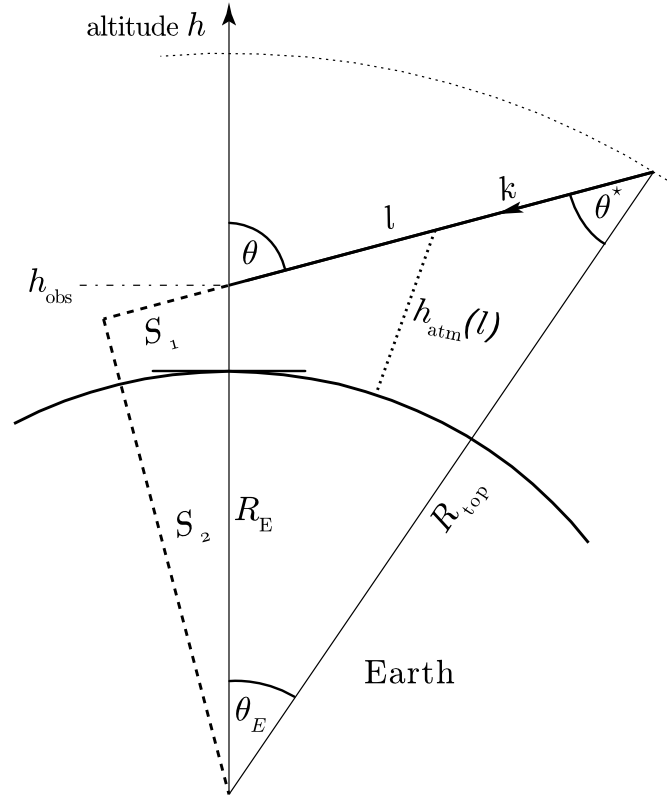
Curved geometry as it is used in the code (not to scale!).#
Example
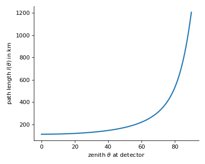
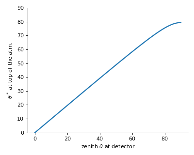
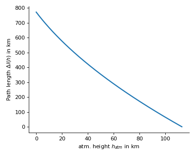
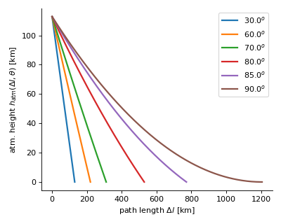
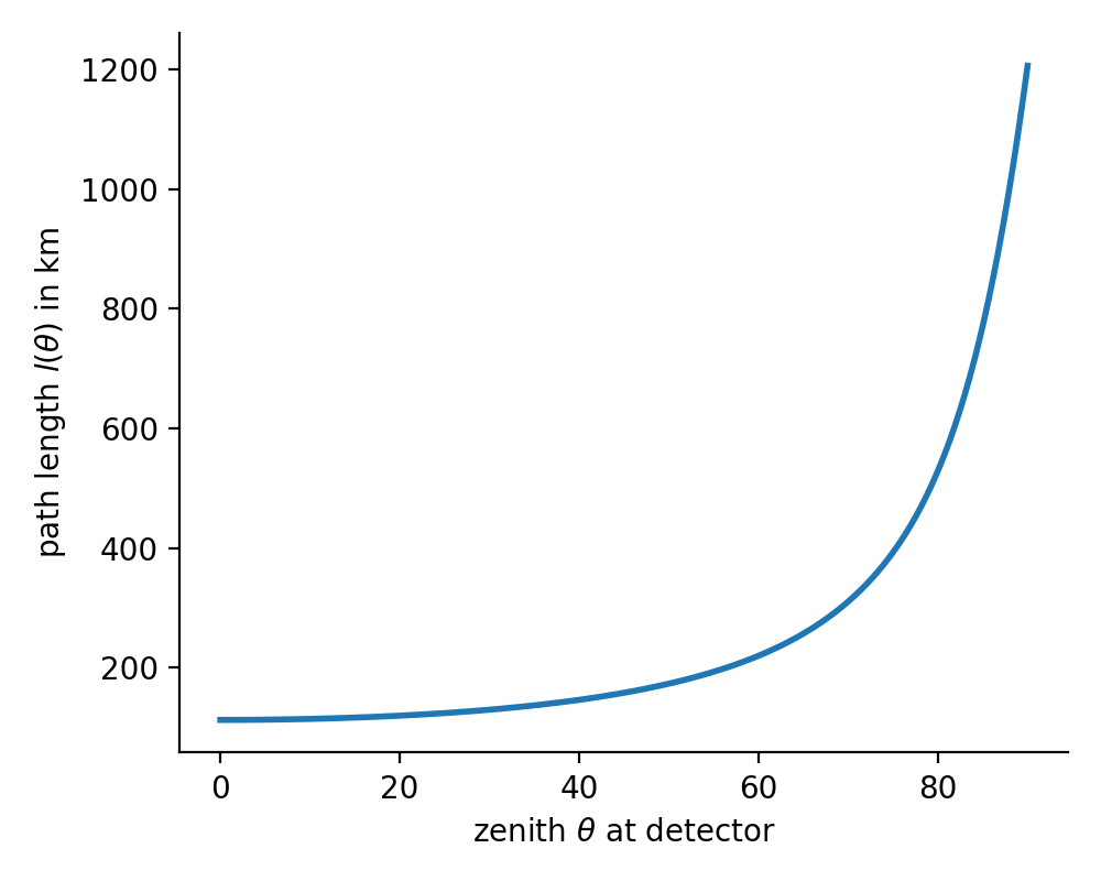
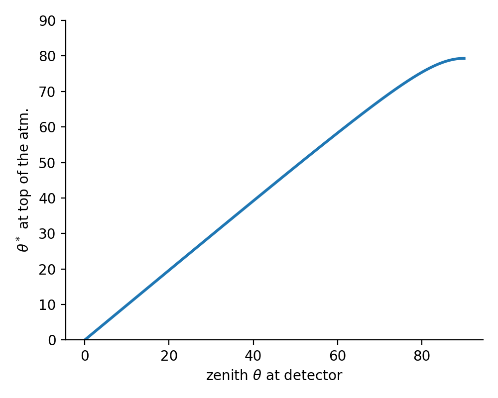
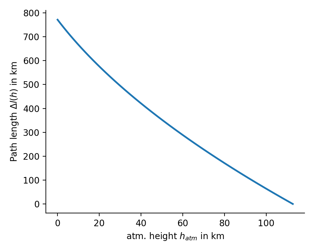
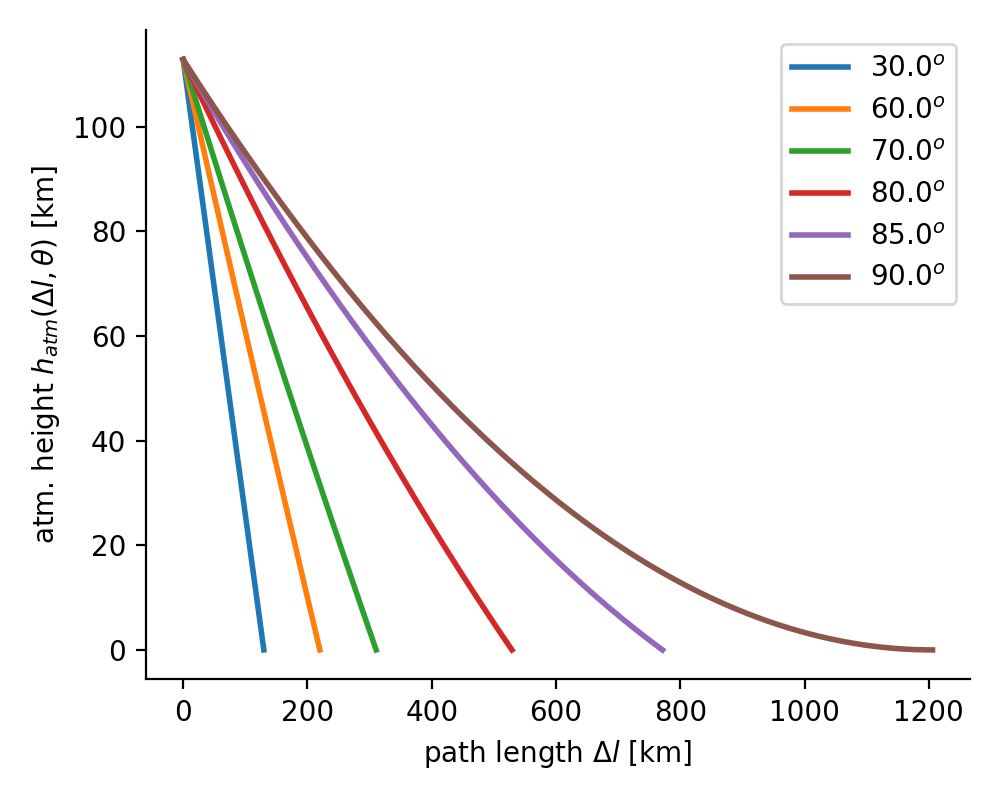
The plots below will be produced by executing the module:
$ python geometry.py
- h_obs#
observation level height [cm]
- Type:
float
- h_atm#
top of the atmosphere [cm]
- Type:
float
- r_E#
radius Earth [cm]
- Type:
float
- r_top#
radius at top of the atmosphere [cm]
- Type:
float
- r_obs#
radius at observation level [cm]
- Type:
float
Methods Summary
cos_th_star(theta)Returns the zenith angle at atmospheric boarder \(\cos(\theta^*)\) in [rad] as a function of zenith at detector.
delta_l(h, theta)Distance \(dl\) covered along path \(l(\theta)\) as a function of current height.
h(dl, theta)Height above surface at distance \(dl\) counted from the beginning of path \(l(\theta)\) in cm.
path_len(theta)Returns path length in [cm] for given zenith angle \(\theta\) [rad].
set_h_obs(h_obs)Set the elevation of the observation (detector) level in cm.
Methods Documentation
- cos_th_star(theta)[source]#
Returns the zenith angle at atmospheric boarder \(\cos(\theta^*)\) in [rad] as a function of zenith at detector.
- delta_l(h, theta)[source]#
Distance \(dl\) covered along path \(l(\theta)\) as a function of current height. Inverse to
h().